Helping You Make Informed Decisions
Our services establish a cost-effective foundation of environmental base data for clients to make better land management decisions. From a high-level desktop analysis over thousands of miles of energy right-of-way to detailed historic aerial change analysis on a 1-acre parcel, we have the resources and capabilities to meet your project needs.
These base data studies provide clear visuals to better understand the environment before setting foot on a site – often leading to savings in site costs, budgeting, and management throughout the life of a project.
Information You Can Rely On
WSSI’s GIS department develops and manages robust spatial data structures that drive powerful and flexible GIS solutions, supporting wetland delineation, permitting, survey, archeology, engineering, and environmental planning. Our team excels in transforming complex geographic information into clear, actionable insights through environmental and hydrological modeling, feasibility studies, aerial photograph interpretation, cultural resource analysis, spatial tracking, MS4 inspection programs, watershed studies, and land cover research. By combining scientific expertise with innovative data management, we deliver accurate, client-focused mapping products that enhance decision-making, regulatory compliance, and sustainable land and water stewardship.
Our GIS team continuously researches, adds, and updates our secure internal digital libraries of both historic and current data and aerial imagery that spans the eastern U.S. and beyond. Having this organized and on-hand spatial information allows us to respond with rapid turn-around in support of project development at any phase.
Services
- Desktop Constraints Mapping
- Field Data Collection Application Development and Support
- Watershed Delineation and Analysis Mapping
- Site Suitability and Alternatives Mapping
- Land Cover and Land Use Analysis
- Hydrologic Modelling Base Maps
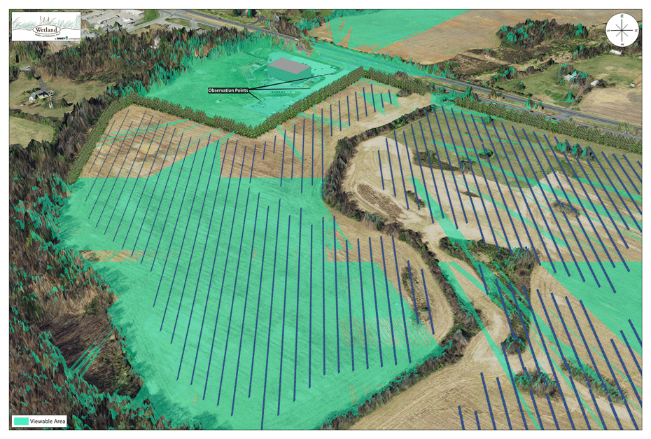
- Viewshed Analysis Mapping/Visual Impact Analysis
- Historic Deed and Plat Overlays
- Environmental Change Analysis
- Aerial Interpretation & Acquisition (existing and new imagery)
- Tree Canopy Assessments
- Right-of-Way Mapping
- Land Ownership and Records Research
- Spatial Data Summaries & Tabular Spreadsheets
- Digital Data Post Processing, Formatting & Deliverables