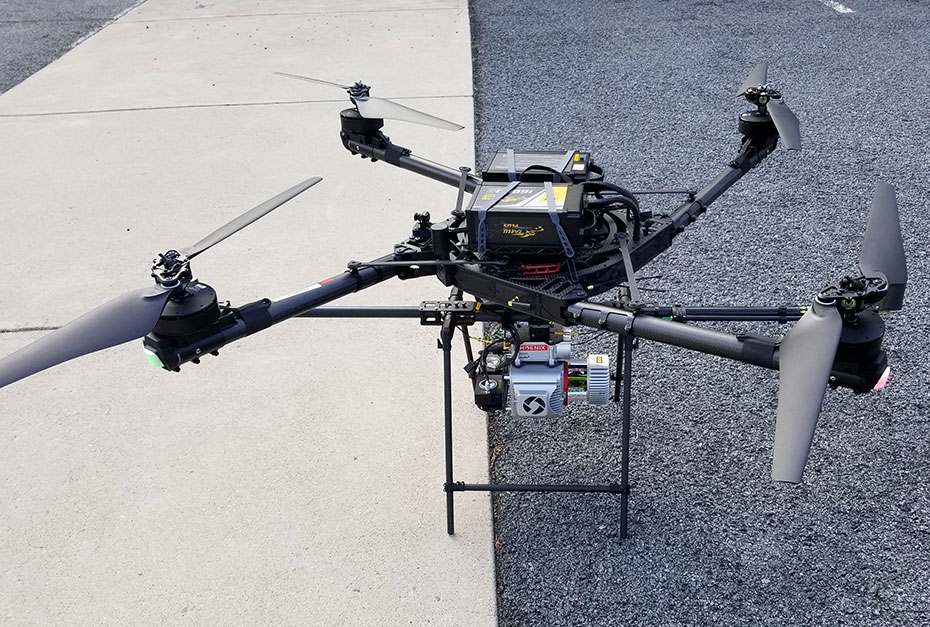
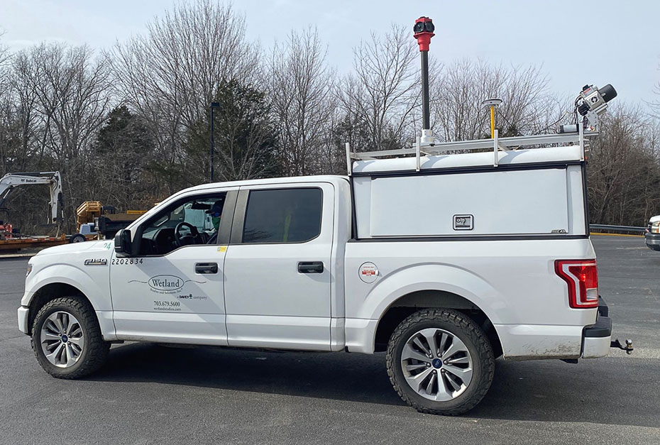
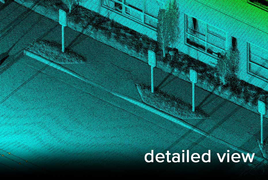
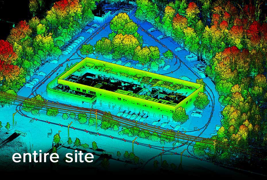
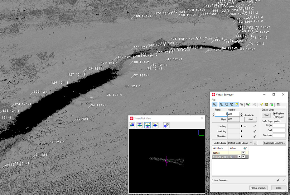
LiDAR, an acronym for Light Detection and Ranging, is an advanced technology used to develop highly accurate, three-dimensional data sets. Wetland Studies and Solutions, Inc. (WSSI) has been using LiDAR data to help our clients acquire survey-grade data for their projects for several years, and we have recently invested in a cutting-edge LiDAR system that can be configured for aerial or mobile collection so we can access difficult locations and efficiently cover expansive project sites. With our data collection and processing entirely in-house, WSSI continues to provide our clients new ways to see their projects and gather intel for informed decision making. The level of detail is astounding: equivalent to being able to see a U.S. quarter on the ground anywhere on the site.

What Does LiDAR Look Like?

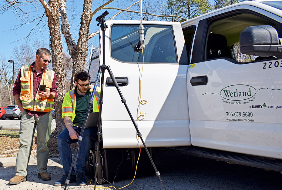
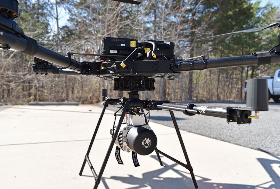
Starting out, LiDAR can look like using a drone or it can look like driving a truck along the subject property to collect 1.5 million data points per second.

After acquisition, post-processed LiDAR data looks like this – a dense, intensity colored point cloud – and WSSI’s reality capture analysts construct a data-rich surface and extract relevant site features that represent the site’s conditions.


Why WSSI for LiDAR?

WSSI’s LiDAR data is always collected and processed by, or under the direct supervision, of a licensed Land Surveyor. As such, we can provide a certified deliverable, ensuring the data is more than sufficient for your project scope. Data accuracy is influenced by processing as much as it is impacted by acquisition, so WSSI is committed to our time-tested methods. We consistently extract accurate topography data through tree leaves and other vegetation by meshing manually-extracted key breaklines and features with computer algorithms.

WSSI’s LiDAR pilots are Part 107 certified (that means they are approved by the Federal Aviation Administration to fly drones, also known as unmanned aerial systems or UASs) and have held those endorsements since the program’s 2016 inception. We frequently operate in the nation’s most complex and restricted airspace, Washington, D.C., which requires waiver applications and following appropriate procedures.

We’re not just the best in the field anymore, we’re the best in the sky too!

Our LiDAR System

WSSI utilizes a Freefly Systems Alta X for aerial acquisitions. The powerful Alta X RTK¹-enabled UAS is an industrial workhorse that carries WSSI’s mission critical payloads (LiDAR, NIR², and RGB³ systems). The Alta X is a U.S. Department of Defense-approved ‘Blue’ UAS, which is authorized for government work.

Our Phoenix LiDAR Systems Ranger LR Lite (Riegl VUX-1 Sensor with Multispectral RGB + NIR Camera) is capable of acquiring highly detailed LiDAR and multispectral (RGB and NDVI⁴) data. The RGB and NIR imagery provides WSSI the opportunity to perform additional analysis in the form of photogrammetry and NDVI evaluations.

Equipment Specs

Altitude: ~ 1,300’ Above Ground Level (AGL)

That’s taller than the Empire State building in NYC! – Although UAS missions are limited to 400’ AGL without a waiver, the payload’s high elevation capability allows us to fulfill waivered project specific scopes. Additionally, the system can be mounted to a helicopter for excessively sized scopes.

Accuracy: ~.04’ (Relative), ~.08’ (Absolute)

About the size of a U.S. Quarter – Thorough due-diligence and conventional testing, WSSI has found that the Phoenix LIDAR system exceeds the accuracies quoted by the manufacturer above. WSSI is able to produce survey-grade topography and certify the data in states we have licensed professionals, surpassing typical state mapping standards or ASPRS guidelines.

Collection Rate: Up to 1.5 Million Points a Second

Collecting over a million points a second allows WSSI to create dense point clouds to resolve features within our datasets that could otherwise be missed.

Number of Returns: 15 (Stores 8)

Arguably one of the most critical features of the LIDAR system is its ability to penetrate canopy and vegetation. Acquiring ground returns is crucial when collecting survey-grade data, and the numerous returns we receive from the Riegl VUX-1 sensor allows WSSI to penetrate foliage and undergrowth.

Get in touch!

WSSI offers acquisition and processing, along with training. Contact us to find out how we can use LiDAR to improve your project processes.


1. RTK: Real Time Kinematics; a real-time kinematics-enabled UAV operates with extreme precision
2. NIR: Near-Infrared light, which is not visible to the human eye due to its low frequency
3. RGB: Red-Green-Blue light, also known as visible light
4. NDVI: Normalized Difference Vegetation Index, which measures the difference between light vegetation absorbs and light it reflects.

Contacts

  • Reality Capture Manager

    Gainesville, VA

  • Chief of Surveys

    Gainesville, VA