The U.S. has long had two different definitions of a foot, but that will officially come to an end on December 31, 2022, with the retiring of the “U.S. survey foot.” Starting on January 1, 2023, the U.S. will officially adopt the “international foot” definition in all applications, according to the October 5, 2020 Federal Register publication of the National Institute of Standards and Technology and NOAA’s National Geodetic Survey’s joint final determination. In a field where there is no room for error, preparing for the change is a serious issue.
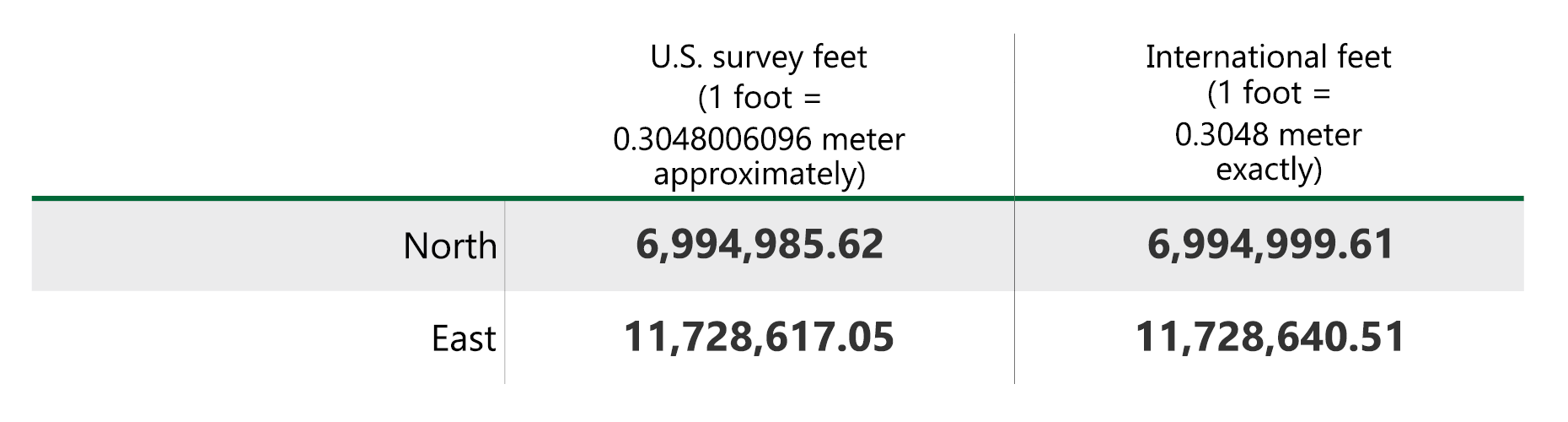
To the average citizen, this change in definition will be of little consequence. The difference between the two definitions is only slightly more than one hundredth of a foot per mile. However, land surveyors, engineers, and mappers will need to make some major adjustments to their procedures. The primary cause for potential complications is that these professions utilize coordinate systems with values in the millions of feet.
For example, a monument on a site in Prince William County, Virginia might have coordinate values of: